
Karst Landscape Features
Imagine standing in a lush green meadow where the ground suddenly dips into a perfect, bowl-shaped crater. You might assume a meteor struck this peaceful field, but the truth hides deep beneath the grass and soil. This surface feature is a silent alarm, signaling that the solid rock below has dissolved into a complex, hidden labyrinth. Understanding these surface clues allows us to map out the invisible world of caves without ever picking up a shovel or drill.
Identifying Surface Indicators of Hidden Caves
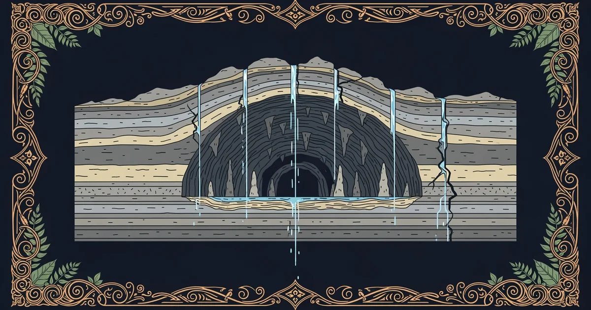
When we look at the landscape, we can see signs of the massive changes occurring underground. The most common sign is the sinkhole, which forms when the roof of an underground cavern collapses under its own weight. Think of this process like a bank account where you constantly withdraw small amounts of money over a long period. Eventually, the balance drops so low that the account cannot support any more spending, leading to a sudden financial crash. In this case, the acid in rainwater slowly eats away at the limestone bedrock until the surface layer lacks the structural support to stay flat. These depressions can range from tiny, shallow pits to massive, gaping holes that swallow entire trees or buildings.
Beyond simple sinkholes, the entire shape of the land often shifts to accommodate the dissolving rock beneath our feet. A karst landscape describes a region where the terrain is dominated by these unique features caused by chemical weathering. In these areas, you will often notice that surface streams suddenly vanish into the ground. These disappearing rivers are essentially plumbing systems that have redirected their flow into the cracks and fissures of the bedrock. Once the water enters these hidden paths, it travels through dark channels before eventually resurfacing miles away at a natural spring. Watching a river end abruptly in the middle of a forest is a clear sign that a cave system is actively shaping the geography below.
Key term: Karst landscape — a geological area where the dissolution of soluble bedrock creates distinct surface features like sinkholes and disappearing streams.
Categorizing Surface Features
To better understand how these features interact, we can look at the physical evidence left behind by the water. The following table highlights the primary surface indicators that geologists use to identify cave systems in the field:
| Surface Feature | Primary Cause | Visual Indicator |
|---|---|---|
| Sinkhole | Bedrock collapse | Circular bowl-shaped depression |
| Disappearing Stream | Water redirection | River ending at a rocky hole |
| Natural Spring | Water resurgence | Constant flow from a rock wall |
These features act as a window into the subsurface environment. When you see a cluster of these signs, you are looking at a highly active drainage network. Each feature is a piece of a larger puzzle. By connecting the location of a sinkhole to the point where a stream vanishes, scientists can predict the direction of underground tunnels. This mapping process is vital for protecting the environment and ensuring that surface activities do not pollute the delicate ecosystems hidden deep within the dark, rocky chambers below.
The surface features of a karst landscape act as physical evidence of the ongoing erosion and structural collapse occurring within hidden underground cave systems.
The next Station introduces the concept of erosion timeframes, which determines how long it takes for these massive underground voids to form.