Predicting Rural Sites
In 2012, researchers mapping the rural landscape of the English Midlands discovered a hidden Roman villa by analyzing subtle crop marks in satellite imagery. This specific discovery demonstrates how Predictive Modeling from Station 11 applies to wide, open spaces instead of crowded city streets. When archaeologists look for sites in rural areas, they cannot rely on the dense layers of construction found in urban zones. They must instead focus on how ancient people interacted with the natural environment to survive. This process requires looking at the land as a series of resources that dictated where humans built their homes.
Analyzing Environmental Variables
To predict where rural sites exist, researchers identify specific environmental factors that ancient people prioritized for their daily survival. These variables act like a checklist for potential settlement locations, helping experts narrow down vast landscapes into manageable search grids. Just as a modern developer chooses a location based on road access and utility connections, ancient farmers selected plots based on reliable water and fertile soil. By mapping these features, we can create a probability map that highlights areas with the highest potential for finding buried ruins.
Key term: Environmental Variable — a measurable natural feature, such as soil type or water proximity, that influences where humans choose to settle.
When we evaluate the landscape, we look at several core factors that consistently influenced ancient settlement patterns across different time periods:
- Soil drainage quality determines whether a location remains habitable during wet seasons without flooding or trapping excess moisture.
- Proximity to permanent water sources like rivers or springs provides essential hydration for crops, livestock, and human consumption needs.
- Elevation and slope steepness indicate whether a site offers natural defense or protection from harsh winds and cold air pockets.
- Access to natural transit routes like valleys or ridges allows for easier movement of goods and travel to other settlements.
Applying Predictive Logic
Predicting rural sites is much like managing a business budget where resources must be allocated to the most profitable locations. If you place your resources in a spot with high potential, you increase the likelihood of a successful return on your investment. In archaeology, the investment is the time spent digging, and the return is the discovery of a significant historical site. By using statistical software, we can weigh these environmental variables to see which combination most often correlates with known archaeological finds in the region.
| Variable Type | Primary Goal | Influence Level |
|---|---|---|
| Hydrology | Water access | High importance |
| Topography | Defense/Safety | Medium importance |
| Soil Quality | Agriculture | High importance |
| Transit Path | Connectivity | Low to Medium |
This table shows how different factors hold varying weights depending on the specific culture being studied. For example, a nomadic group might prioritize transit paths, while a farming community would prioritize soil quality above all else. By adjusting these weights in our models, we can tailor our search to the specific needs of the people who lived there. This method allows us to move beyond guessing and start using data to drive our archaeological exploration efforts across the countryside.
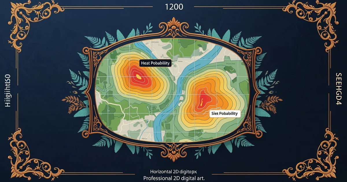
When we combine these data points, we create a heat map that shows where ancient people were most likely to build their lives. This model helps us protect heritage sites by identifying them before construction projects potentially destroy them forever. By knowing where sites are hidden, we can plan development to avoid these areas entirely. This proactive approach turns archaeology into a tool for land management rather than just a way to study the distant past. It bridges the gap between historical research and modern planning in a way that benefits everyone involved in the process.
Predictive modeling in rural areas uses natural environmental features to identify where human activity was most likely to occur.
But this model breaks down when shifting climate patterns or extreme weather events alter the landscape so much that the original environmental data no longer matches the current reality.