Landscape and Settlement Patterns
Imagine you are choosing a spot to build a house in an empty forest today. You would likely look for flat ground near a clean water source to make daily life easy. Ancient people made these same practical choices when they decided where to build their homes. They needed water for drinking and farming, and they wanted flat land to avoid the heavy labor of building on steep hills. By looking at these simple factors, we can guess where they lived thousands of years ago.
Environmental Drivers of Settlement
When we study ancient landscapes, we see that humans rarely settled in random or difficult locations. They treated site selection like a business investment where they sought the highest return for the least effort. If a group settled near a river, they gained easy access to water, transport, and fertile soil for their crops. This environmental determinism suggests that the physical world dictates human choices by limiting where survival is possible. While people have free will, the need for water acts as a strict filter that removes impossible locations from the map. Archaeologists use this logic to narrow down large search areas into smaller, more likely zones.
Key term: Environmental determinism — the theory that the physical environment and geography directly shape the cultural and social development of human societies.
Topography also plays a massive role in how people organize their living spaces over long periods. Flat land is much easier to clear, build upon, and defend against intruders compared to rugged mountain terrain. Think of this like choosing a location for a new store; you want high foot traffic and easy access rather than a hidden spot on a cliff. When a site sits on a gentle slope, it offers good drainage and a clear view of the surrounding area. These factors provided a survival advantage that ancient groups valued highly when they picked their long-term homes.
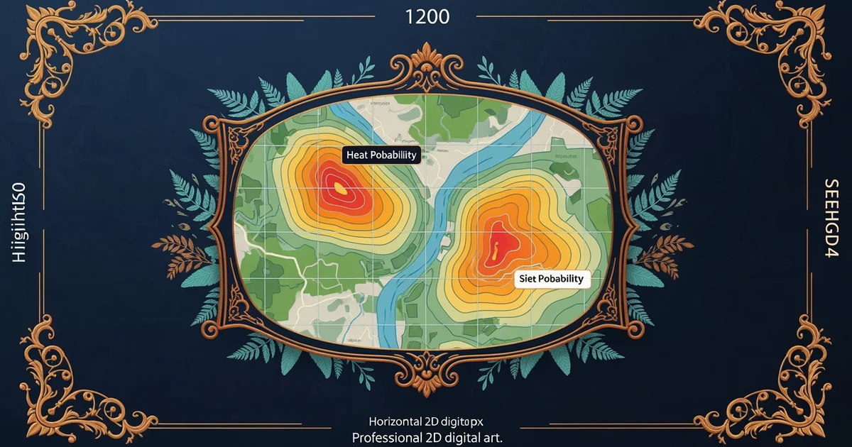
Analyzing Landscape Patterns
We can categorize how these environmental factors influence the placement of ancient settlements by looking at specific physical traits. Each trait acts as a weight that increases or decreases the likelihood of finding human remains in a specific spot. The following table compares how these features impact the decisions made by ancient planners during the selection process.
| Feature | Primary Benefit | Secondary Benefit | Settlement Risk |
|---|---|---|---|
| Water Source | Daily survival | Irrigation potential | Flooding hazards |
| Gentle Slope | Ease of construction | Natural drainage | Erosion issues |
| High Ground | Defense advantage | Flood protection | Limited resources |
By mapping these features, researchers create a visual guide that highlights areas with the most favorable conditions for human activity. This process is similar to a real estate agent scoring properties based on location, size, and nearby amenities to find the best value. If a location has a high score for water access and slope stability, it becomes a high-priority target for future field surveys. This method helps us save time and resources by focusing our efforts on the most promising patches of land.
Predictive modeling relies on the assumption that humans are creatures of habit who prefer efficiency over struggle. If we find ten sites in a valley that all sit near water, we can reasonably guess that an eleventh site exists in a similar spot nearby. This pattern recognition is the heart of archaeological science because it turns a vast, unknown landscape into a structured map of possibilities. We are essentially learning the rules of a game that was played by people who lived long before us. By understanding their needs, we gain a clear window into the past that remains hidden beneath the soil today.
Human settlement patterns are predictable because ancient societies consistently chose locations that maximized access to vital resources while minimizing physical labor.
Now that we understand how landscape choices function, we will examine the specific data sources that allow us to map these ancient patterns.