
Groundwater Systems
Deep beneath your feet, vast amounts of water move slowly through hidden cracks in the solid rock. You might walk over dry ground every single day, yet you are actually standing atop a massive storage tank of vital liquid resources. This invisible supply sustains life in many regions where rivers run dry or rainfall remains sparse for months. Understanding how this water hides and flows is the first step toward managing our most precious natural resource for the future.
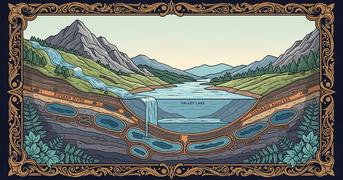
The Architecture of Hidden Reservoirs
Geologists use the term aquifer to describe any underground layer of rock or sediment that holds usable amounts of water. Think of these formations like a giant, buried sponge that absorbs moisture from rain and snowmelt over many centuries. The water fills the tiny gaps between individual sand grains or cracks within dense rock structures. This storage process happens very slowly because the water must trickle through tight spaces while moving deep into the earth. Once the water reaches these saturated zones, it stays there until humans pump it out or it finds a natural path to the surface.
Key term: Aquifer — a porous underground geological formation that acts as a reservoir by storing and transmitting significant quantities of groundwater.
Water moves through these underground layers based on the size and connection of the spaces between particles. High permeability allows water to flow easily, while low permeability acts like a dam that traps moisture in place for long periods. You can imagine the aquifer as a bank account where nature makes small, slow deposits of water during wet seasons. If we withdraw more water than nature replaces through recharge, the account balance drops and the entire system becomes unstable. Maintaining this balance is essential for ensuring that communities have reliable access to clean water during dry cycles.
Mapping Underground Movement
Water does not sit perfectly still, even though it appears trapped deep within the dark, heavy layers of stone. Gravity pulls the water downward and outward, forcing it to seek the lowest point in the landscape through a process called infiltration. This movement is often compared to money flowing through a complex financial network where different branches hold varying levels of capital. Some areas act as high-flow channels that move water quickly, while others serve as slow-moving vaults that store resources for decades. Mapping these pathways requires careful study of the rock types and the pressure levels found at different depths.
| Feature | Function | Flow Speed |
|---|---|---|
| Recharge Zone | Surface intake | High |
| Porous Rock | Water storage | Low |
| Confining Layer | Prevents escape | Very Low |
Understanding the specific role of each layer helps scientists predict how fast water will travel toward a well or a spring. We must monitor these zones to prevent contamination from reaching the deeper, cleaner parts of the storage system. If a pollutant enters the recharge zone, it can spread through the entire network and ruin the water quality for everyone nearby. Protecting these pathways is just as important as managing the volume of water held within the rock layers themselves.
By studying these systems, we learn that groundwater is not an infinite supply but a finite savings account. We must treat this resource with care to ensure that future generations inherit a stable and healthy water supply. The movement of water through the ground is a delicate process that requires constant observation and responsible management from all users. Every drop we save today helps keep the entire underground system healthy for the decades that will follow our own time.
Groundwater systems act as massive, slow-moving underground reservoirs that require careful management to balance human consumption with natural recharge rates.
The next Station introduces Surface Water Dynamics, which determines how water flows across the landscape and interacts with these deeper storage zones.